Nordøyane’s Peaks
Your Hiking Checklist
From fjord to summit! The five islands of Nordøyane offer many fantastic peaks to conquer. Here’s a good list for hiking enthusiasts!
The Peaks
Goaldet
Harøyburet
Mannen
Røhammaren
Skulen
Storhaugen
Ullahornet
Æafjellet
Goaldet (Lepsøya)
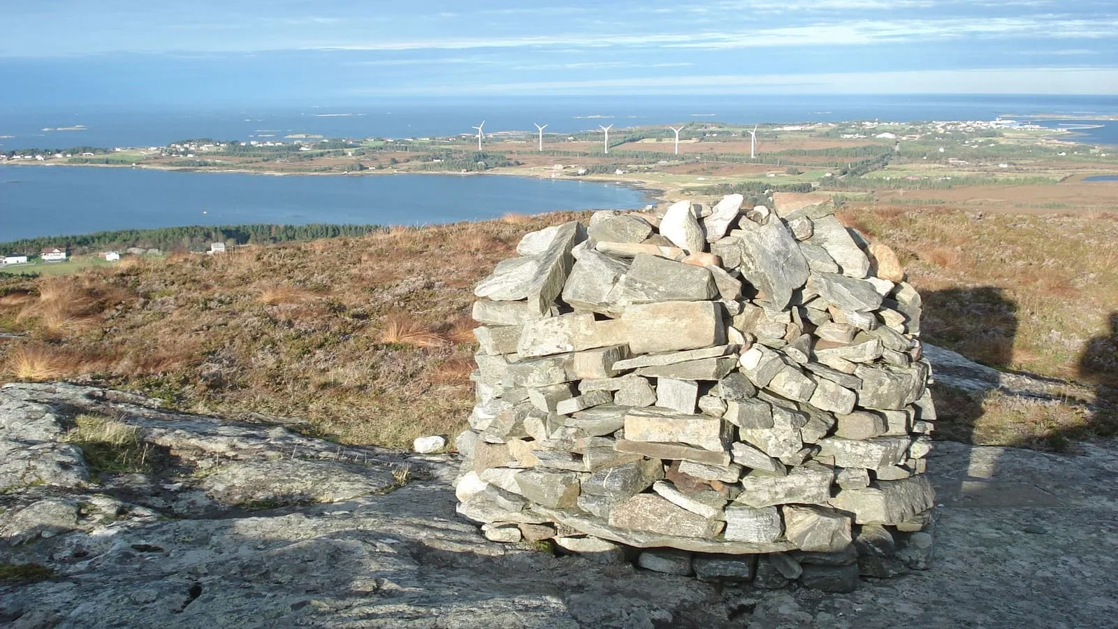
The mountain Goaldet is definitely worth the trip, rising 490 meters above sea level. At the summit, you’ll find a well-built stone cairn. The view is simply majestic from here, overlooking the ocean, the surrounding islands and mountains.
Just below the peak, there’s a charming stone hut, built by Lepsøy Idrettslag and dedicated volunteers. It’s the perfect spot to enjoy your packed lunch while taking in the stunning views of Romsdalsfjorden and the surrounding mountains. You can even stay overnight! (A cozy wood stove has been installed in the hut for heating, but you’ll need to bring your own firewood.)
- Difficulty level
- Moderate
- Estimated duration
- 2 hours 10 minutes
- Season
- All – spring, summer, fall and winter
- Trail markings
- Yes
- Mobile coverage
- Yes
For more details about the hike, see Hytta ved Goaldet på Lepsøya at Morotur.
Harøyburet (Harøya/Finnøya)
Harøyburet may not be a towering peak at 156.2 meters above sea level, but sometimes that’s just right for a perfect hike. From the summit, you’ll enjoy beautiful views of the island landscape to the north and south. The trail to Harøyburet follows an easily accessible gravel road and path, though some sections are quite steep. In winter, the route is neither plowed nor sanded, so hikers must assess the conditions themselves.
- Difficulty level
- Moderate
- Hike length (round trip)
- 4.93 kilometers
- Estimated duration
- 1 hour 40 minutes
- Season
- All – spring, summer, fall and winter
- Trail markings
- Yes
- Mobile coverage
- Yes
For more details about the hike, see Harøyburet on Morotur.
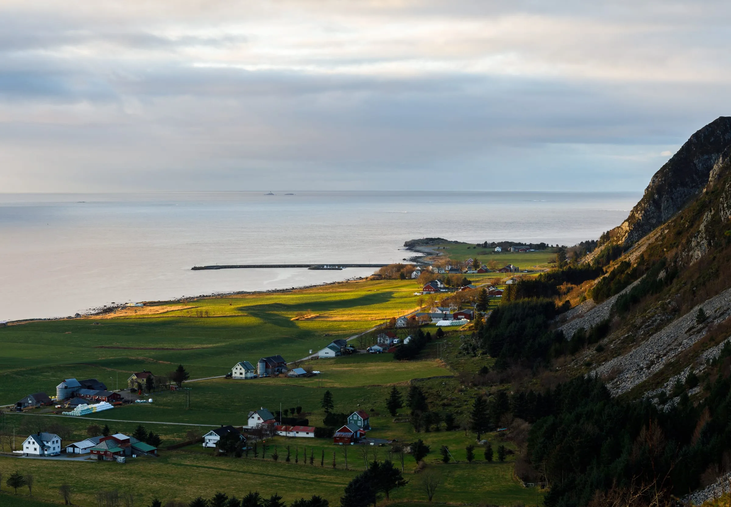
Mannen (Haramsøya)
Mannen is the highest mountain on Haramsøya, standing at 371 meters above sea level. Along the hike, you’ll often spot ravens and eagles, and from the summit, you can simply take in the awesome views.
From here, you can see south to the city of Ålesund, across to the neighboring island of Lepsøya, the village of Haram, and out over the vast ocean. To the east, you’ll spot Flemsøya/Skuløya and Ullahornet, a steep north-facing coastal mountain of great conservation value. You’ll also have a clear view of Haramsfjellet, where wind turbines stand against the landscape.
- Difficulty level
- Moderate
- Hike length (one-way)
- 1.5 kilometers
- Estimated duration
- 2 hours
- Season
- All – spring, summer, fall and winter
- Trail markings
- Yes
- Mobile coverage
- Yes
For more details about the hike, see Mannen on Morotur.
Røhammaren (Haramsøya)
Bring your packed lunch and enjoy it on the bench at the top of Røhammaren. The trail has a steady incline all the way up, and from the summit at 179 meters above sea level, you’ll be rewarded with great views to the north. On the way down, you can take a detour to Stormyrhytta; the trail is well signposted. There, you’ll find a fire pit, kayaks, and even an outhouse. A truly charming hike!
- Difficulty level
- Easy
- Hike length (one way)
- 3.6 kilometers
- Estimated duration
- 1 hour
- Season
- All – spring, summer, fall and winter
- Trail markings
- Yes
- Mobile coverage
- Yes
For more details about the hike, see Røhammaren Haramsøy on Morotur.
Skulen (Flemsøya/Skuløya)
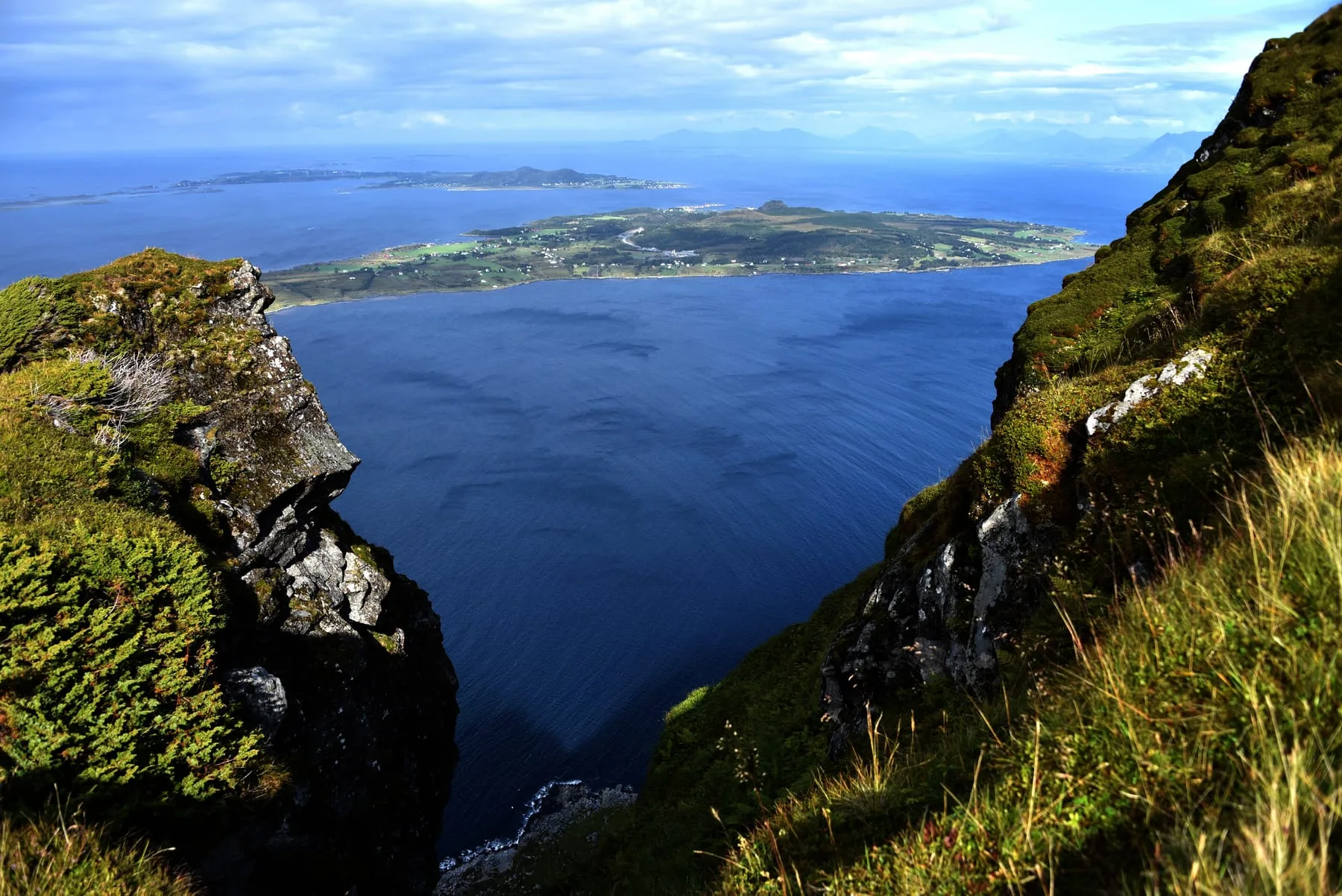
Skulen offers a breathtaking 360-degree panoramic view. Located 492 meters above sea level it is the highest point on Flemsøya/Skuløya. From the summit, you can see the horizon over the open ocean and the sharp peaks of the Sunnmøre Alps if you turn.
- Difficulty level
- Moderate
- Hike length (one way)
- 1.34 kilometers
- Estimated duration
- 2 hours 45 minutes
- Season
- All – spring, summer, fall and winter
- Trail markings
- Yes
- Mobile coverage
- Yes
For more details about the hike, see Skulen on Morotur.
Storhaugen (Lepsøya)
Storhaugen sits at 289 meters above sea level, with a trail leading there from Goaldet - thus making it possible to conquer two peaks in one hike. The view over the ocean is awesome, but the mountainsides are steep. For a safer descent, take the trail down toward Hellevika. Better safe than sorry, of course.
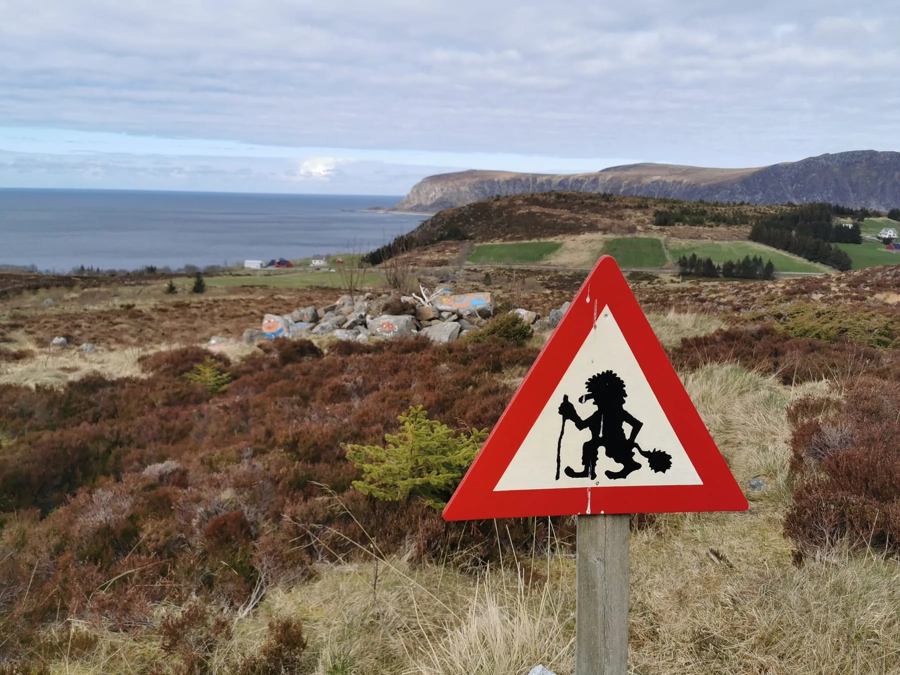
Ullahornet (Haramsøya)
Ullahornet rises 334 meters above sea level on the northern side of Haramsøya, featuring steep, dramatic cliffs facing the open ocean. The peak is part of the popular “Haramsøya på langs” ridge walk – a longer route that runs from Røhammaren across to Ullahornet, then continues past Hestevollane and Nova before descending to the village of Ulla.
From Ullahornet, you can look out toward Ulla Lighthouse and the vast Atlantic horizon. Keep an eye on the rock formations along the way – at one point, the silhouette of the mountain is said to resemble the profile of Bjørnstjerne Bjørnson, the Nobel Prize-winning Norwegian author.
Ullahornet can be reached as part of the “Haramsøya på langs” route. For the starting section, see Røhammaren Haramsøy on Morotur.
Æafjellet (Fjørtofta)
Fjørtofta is a relatively flat island, with Æafjellet as its highest point at 113 meters above sea level. This is a great hike suitable for all ages.
- Difficulty level
- Easy
- Hike length (one way)
- 1.34 kilometers
- Estimated duration (one way)
- 55 minutes
- Season
- All – spring, summer, fall and winter
- Trail markings
- Yes
- Mobile coverage
- Yes
For more details about the hike, see Æafjellet on Morotur.
Have a great hike at Nordøyane!
Explore Nordøyane →